Services - Data Development
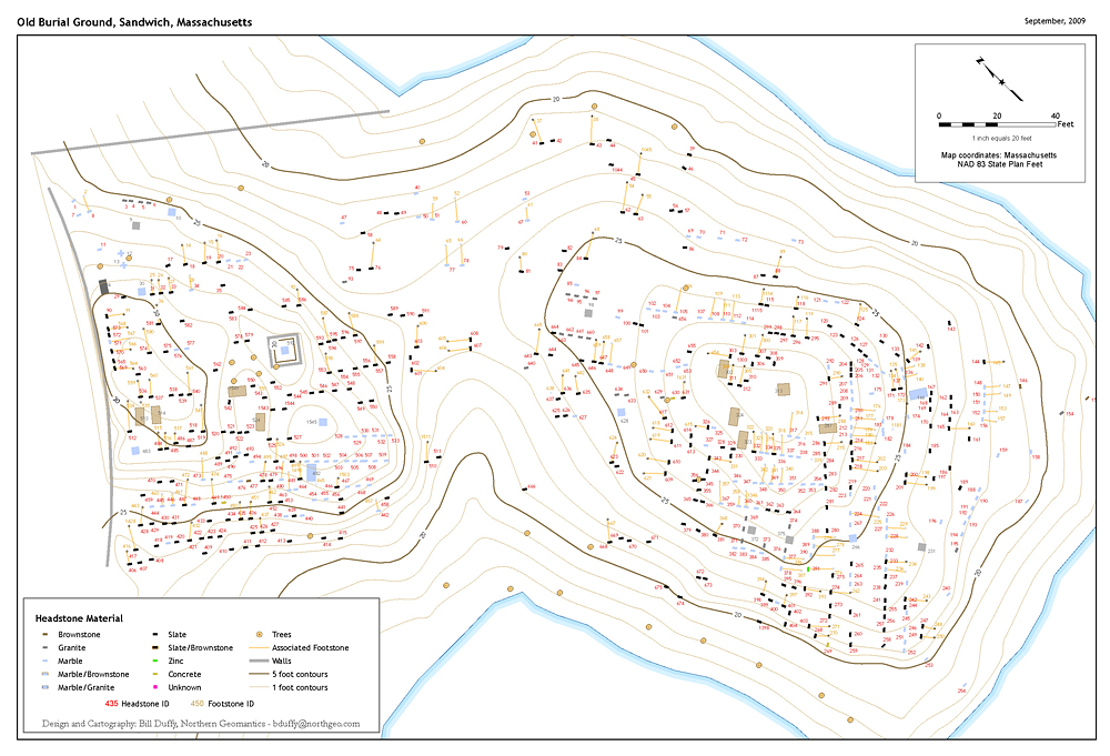
Northern Geomantics expertise in GIS data development is a result of years spent working in the trenches with a variety of agencies and organizations in the creation, coding and integration of geospatial information into a GIS. NorthGeo has helped state agencies create data layers for wildlife habitat, coastal access, bathymetry, and viewsheds. We have assisted towns and cities in developing spatial information for everything from parcels to parking spaces and trails to tree inventories. NorthGeo has partnered with historical organizations to inventory and map headstones, stonewalls, notable buildings and old rail lines. Click on the thumbnails to the right to see some examples of recent data development projects.


Copyright Northern Geomantics, 2013